
Unlike the other eastern rivers, which started at the TOP of the Appalachian Mountain Chain, only the Mohawk in New York State started on the WEST SIDE of the Ridge, and flowed ACROSS the mountains to the Atlantic.

The red arrows in the left image are pointing to the original Erie Canal (the fine line) that was dug alongside the Mohawk River (the bolder line) across the Appalachian chain in Eastern New York State. For millenia the Mohawk had been carving a valley across this region, so when the Erie Canal was dug – complete with it’s towpath – alongside the Mohawk, it wasn’t about being near the River: It was about being in the groove that the river had cut for them through the mountains.

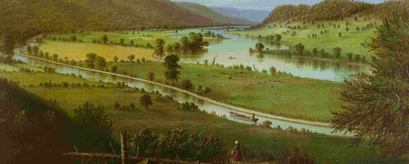
At the time of the Revolution, America inherited claims to vast tracts of western lands, but owning and keeping were two different things! Our young nation desperately needed to establish trade routes across the formidable Appalachian mountain chain. Other efforts failed, but here in New York State the Erie Canal succeeded, and perhaps the one most important reason for its success can be seen in the picture above. This location is known as “The Noses” because the two ends of the mountain that was cut in two by the flow of the Mohawk River resemble noses (see below). This site, which is just a few miles east of Canajoharie, was the only gap in the Appalachian chain that made canal construction possible with early nineteenth-century construction techniques. The image above shows the Erie on the south side of the Mohawk River along this stretch during the towpath era. The photograph below shows the same view as it appears today. The Mohawk River was “canalized” in 1905-1918 because animals were no longer needed to propel Erie barges. The New York State Thruway now passes through here near the old Erie’s course.
