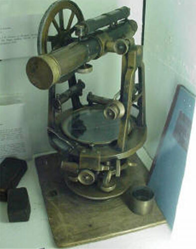
Early surveyors used transits like this one to lay out the course of the original Erie Canal across New York State. Though cutting-edge for their day, these instruments were primitive by modern standards, and were prone to errors due to careless use and to rough handling (e.g. being carried on horseback).

Even without errors, the task of finding a level route for a canal in that day was a daunting one. Transits were “line of sight” tools and New York State was a wilderness of trees then. Survey teams consisted of a few men to survey, and a dozen or more axe-men to clear a path through the foliage ahead of them. Their job was to not only find as level a route as possible, but also to make sure there was an adequate water supply that could flow down to the canal to supply its needs.
That water supply not only had to be high enough to flow down to the canal’s level, but it also had to provide enough water to not run dry during dry spells, and busy times when frequent use of locks demanded the most water. Their success is an essential part of the Erie’s fame as one of the great engineering feats in American History.
The Original Erie Canal had three high-spots.
Can you find them on this 1832 profile?

(click or tap for larger version)
Each of those three high-spots needed a source of water that was higher than they were. There are no pumps in the Erie Canal today, and there were certainly none in 1825. Finding those sources – and estimating their ability to provide enough water – was one of the most important jobs of the early surveyors of the canal!